North and Biogradska Gora
Mountain Monténégro: the primary forest of Biogradska Gora, shepherd katuns between 1500 and 1900 metres, and access to the Prokletije at the Albanian border.
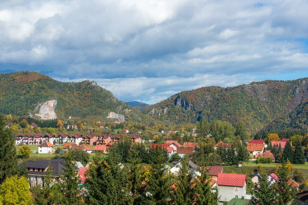
Northeastern Monténégro is another world compared to the Adriatic coast. Here, average altitude exceeds 1000 metres, winters last five months and population density drops below 15 inhabitants per km². Our team at Podgorica recommends this region to travellers seeking inhabited mountains, ancient forests and a rural Monténégro that the coast scarcely hints at.
The heart of the zone is Biogradska Gora National Park, established in 1952 on lands that King Nikola had placed under protection as early as 1878. Spanning 5650 hectares, it shelters one of Europe's three remaining primary forests: beeches, spruces and sycamore maples, some exceeding 45 metres in height and 500 years in age. The glacial Biograd Lake, at 1094 metres, occupies its centre. Six other high-altitude lakes hide higher in the Bjelasica massif, including Pešića jezero at 1838 metres, reachable after three hours' walk from the main lake.
Kolašin, at 954 metres altitude, serves as the logistical hub. The town has 2700 inhabitants, a small ski resort (Kolašin 1450 and 1600) open from December to March, and a renovated centre around Boris Vukmirović Square. From Podgorica, the road climbs the Morača canyon for nearly 100 kilometres, passes the Morača monastery founded in 1252, celebrated for its 13th-century frescoes, then rises to the plateau. Allow two and a half hours by car, or take the Belgrade-Bar railway line, which crosses 254 tunnels and 234 bridges, including the Mala Rijeka viaduct at 200 metres in height.
Beyond Biogradska Gora, the territory extends to the Albanian and Kosovar border, towards the Prokletije, the "Cursed Mountains". The Zla Kolata peak reaches 2534 metres, the country's highest point. Plav and Gusinje, two small towns at the foot of the massif, maintain a strong Bosniak and Muslim Albanian identity, a legacy of Ottoman migrations. You hear Albanian spoken in the cafés, you eat cicvara, creamy polenta with kajmak, and jagnjetina ispod sača, lamb cooked under an iron bell covered with embers.
The entire region still lives partly to the rhythm of transhumance. From June to September, families move to the katuns, summer pasture hamlets of wood and stone scattered between 1500 and 1900 metres. There are several dozen around the Bjelasica and Prokletije, for example at Katun Vranjak or Eko Katun Štavna. The shepherds make Kolašin cheese, kajmak, and a thick yoghurt they sell to passing hikers. Several katuns are now equipped to accommodate one or two families on half-board, one of the most memorable lodging options we offer in the country.
The climate is continental mountain: short, mild summers, long, snowy winters. The landscapes alternate between conifer forests, alpine meadows, glacial lakes and villages with shingled roofs. It's also a region of isolated Orthodox monasteries, deep canyons (Mrtvica, Tara in its upper section) and secondary roads where you encounter more cows than cars.
To discover
Biogradska Gora primary forest. Loop around Biograd Lake at 1094 metres beneath beeches and spruces over 500 years old, then ascent towards the high-altitude lakes of the Bjelasica between 1600 and 1838 metres.
Night in a summer mountain pasture katun. Stay with shepherds between 1500 and 1900 metres, from June to September, with tastings of kajmak, Kolašin cheese and cicvara prepared on site.
Hiking in the Prokletije. Three to five days' walk from Plav and Gusinje towards Hrid Lake, the Eye of Skakavica or Zla Kolata at 2534 metres, at the Albanian border.
Morača monastery. Founded in 1252 above the canyon, its 13th-century frescoes depicting the prophet Elijah rank among the best-preserved medieval ensembles in the Balkans.
Belgrade-Bar railway line. The Kolašin-Podgorica section of 80 kilometres through tunnels and viaducts, including the Mala Rijeka viaduct 200 metres above the river.
When to go
The best window to discover the region runs from mid-June to late September. Temperatures in Kolašin range between 18 and 25°C during the day in summer, dropping around 10°C at night. This is the only period when the katuns are inhabited, when the high-altitude trails of the Prokletije are passable without specialist equipment, and when roads to the Bjelasica lakes are clear. July and August remain the most stable months, with possible high-altitude thunderstorms in late afternoon. September offers early autumn colours on the beech forests, and far fewer people on the trails.
From November to April, the region shifts under snow. Kolašin commonly records 80 to 120 cm of snow cover between January and March, negative temperatures at night, downhill and backcountry skiing possible. April, May and October are best avoided for high mountain: residual snow above 1500 metres, katuns closed, secondary roads sometimes impassable. May remains interesting for the Morača canyon and monasteries, but not for high-altitude bivouacs.
Practical advice
Allow a minimum of three full days on site to justify the ascent from the coast or Podgorica: one day for Biogradska Gora park and Morača monastery, one night in a katun with a day's walk, and one or two extra days if you venture to the Prokletije via Plav and Gusinje, two hours' drive from Kolašin. The logical entry point is Podgorica airport, followed by the E65/E80 road or train to Kolašin. For travellers coming from Belgrade, the direct railway line is an alternative we readily organise.
The region combines very well with Durmitor park to the west, two hours' drive via Mojkovac and the Tara canyon, for a complete six to seven-day mountain circuit. Another logical link connects the north to Skadar Lake then the Bay of Kotor, descending progressively towards the coast. Comfort remains rural: small family hotels in Kolašin, guesthouses in Plav, mountain huts and katuns in high altitude with shared facilities. This is a destination for hikers, contemplatives, mountain gastronomy enthusiasts and travellers who appreciate direct contact with local people. Families with young children will find plenty to enjoy around Biogradska Gora, but not in the Prokletije, where elevation gains are serious.